WHOA! If you wind up hiking Angels Landing in Zion National Park, I guarantee you will repeat this phrase more than once. And I’ll tell you why. Because Angels Landing has some of the most amazing and mind-blowing drop-offs on both sides of the trail up to the summit. How steep is it? Let’s just say this is NOT a hike for anyone with a fear of heights. If you look over the edge you might get a touch of vertigo. Than what the heck was I doing hiking it? I have a slight fear of heights, but my curiosity for new hiking experiences will usually trump my fears. Angels Landing is one of the best trails in the US and one of the most adventurous hikes in Zion National Park and I did not want to miss out.
Trail Name: Angels Landing
Trail Details
- Length: 5 miles (round trip)
- Peak Elevation: 5,785 ft
- Gain/Loss: +1,488 ft
- Difficulty: Strenuous
- Time: 5 hours
- Location: Zion National Park
Angels Landing is categorized as a “strenuous” hike. It is not strenuous because of the length of the hike. It is only 5.4 miles roundtrip and takes an average of 4 hours to complete. It is not even really that strenuous because of the elevation gain. Total gain is about 1488 feet. In comparison, the hike to Half Dome has a total elevation gain of 4800 feet! When you look out at the summit and the trail before you, it looks almost impossible to climb. It’s the switchbacks and the very steep end of this trail that makes this one strenuous. But it can be done! Before I scare you off, let me say that I highly recommend this hike. It is a one-of-a-kind experience to sit atop the summit and gaze out at an unbelievable view of the park below. I would say if you are in decent shape, and won’t freak out due to a fear of heights you should definitely try this hike.
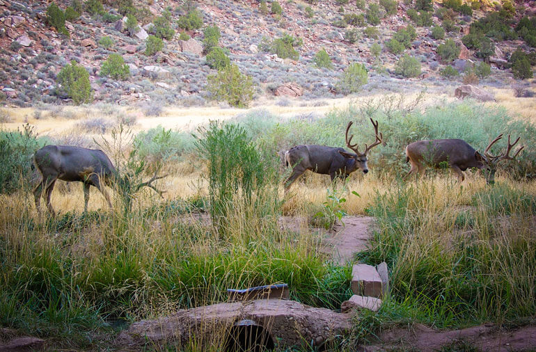
After a restful night of camping we prepared our gear, then boarded one of the parks free shuttle buses destined for The Grotto Trailhead. There are picnic tables and bathrooms here so it’s a good idea to empty your tank before you head out. While we prepared for our hike, the three deer above were busy chomping down on some yummy grass for breakfast.
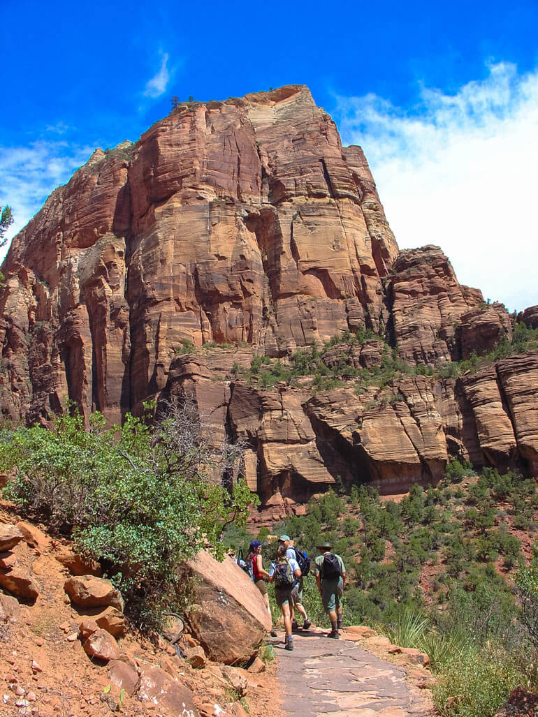
After crossing the bridge over the Virgin River, we headed up the West Rim Trail. Our destination is the summit of that canyon peak in the image above. Looks pretty tall and from the size of the trees, looks like it is a long ways away. But the sun was out, the day was comfortably warm and excitement filled our bones.
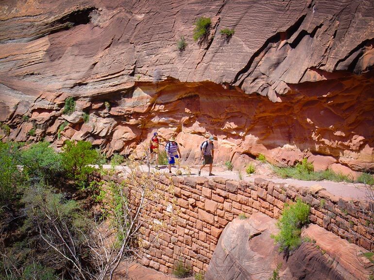
The West Rim Trail is well paved and follows the canyon wall. The cool thing about this trail is the color that you’ll notice as your walking along. The walls are orange mixed with stripes of white and some light shades of brown. The trees are bright green, and if your lucky, the sky will be a magnificent blue. The colors really do contrast to make a beautiful national park. I was amazed at how much green trees and shrubs were scattered all around the trail, sometimes even growing right out of the canyon wall!
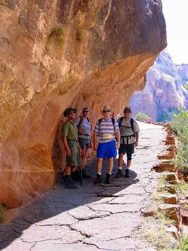
At the beginning of the hike you will be exposed to sun most of the time. Depending on where the sun is, there may be pockets of shade created by the small overhangs of the canyon wall. This is much appreciated especially if your hiking on a hot day.
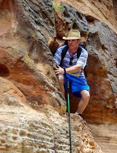
After a few hours in the sun, we entered Refrigerator Canyon. It’s easy to see how this part of the trail got it’s name. The canyon wall is so high it shades most of the trail making it much cooler. Also the trail is less of a climb here. It’s a great place to take a break and explore the little slots and caves next to the trail. The guy in the blue shorts is Dan or as we called him, “Adventure Dan”. He is demonstrating how he can carefully scale the rocks. Don’t worry you won’t have to do this. He was just having fun trying to do his best Indiana Jones impersonation. The trail here is actually very nicely paved and safe.
After hiking a little further we reached the next section of the trail called Walter’s Wiggles. If you look up you can tell that this is the serious part of the hike. We climbed the 21 short but steep switchbacks that traversed vertically to the top. I took a picture of this part of the hike but it really didn’t do the switchbacks any justice. Click this link to see a better picture of what Walter’s Wiggles looks like. Pretty crazy right? You can see from that image that the path is still pretty nicely paved. That all changed once you reached the top of the switchbacks though.
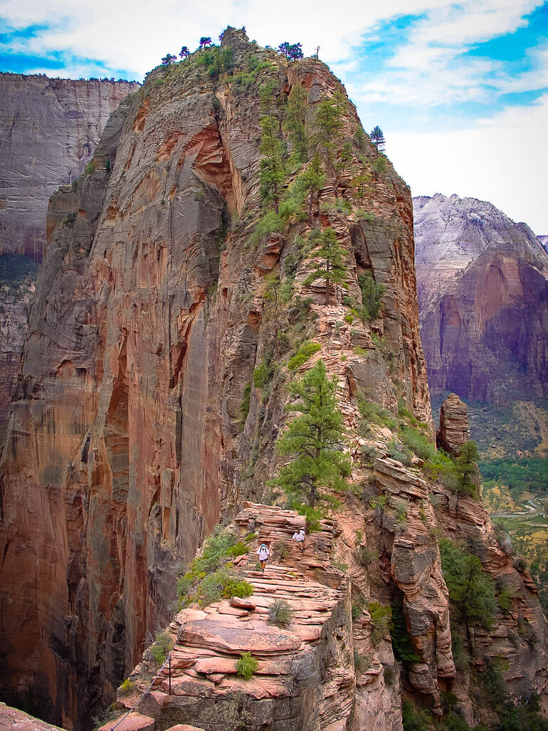
Scout Lookout was the next checkpoint reached right after finishing Walter’s Wiggles. Remember that word “Whoa” that I mentioned? That’s exactly what I said when I saw the view of the remainder of the trail to the final summit. This is the place where people with a fear of heights usually decide to turn back. Just look at that um…trail. Not for the faint of heart! But again, I encourage you don’t give up if you made it this far. Just approach the rest of the trail very slowly, deliberately and carefully and you’ll be fine. Can you see the people on the trail in the image above? They are on their way down from the summit. Try to follow the trail behind them that snakes all the way to the top.
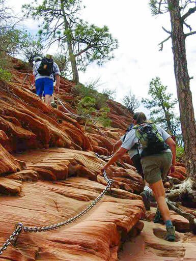
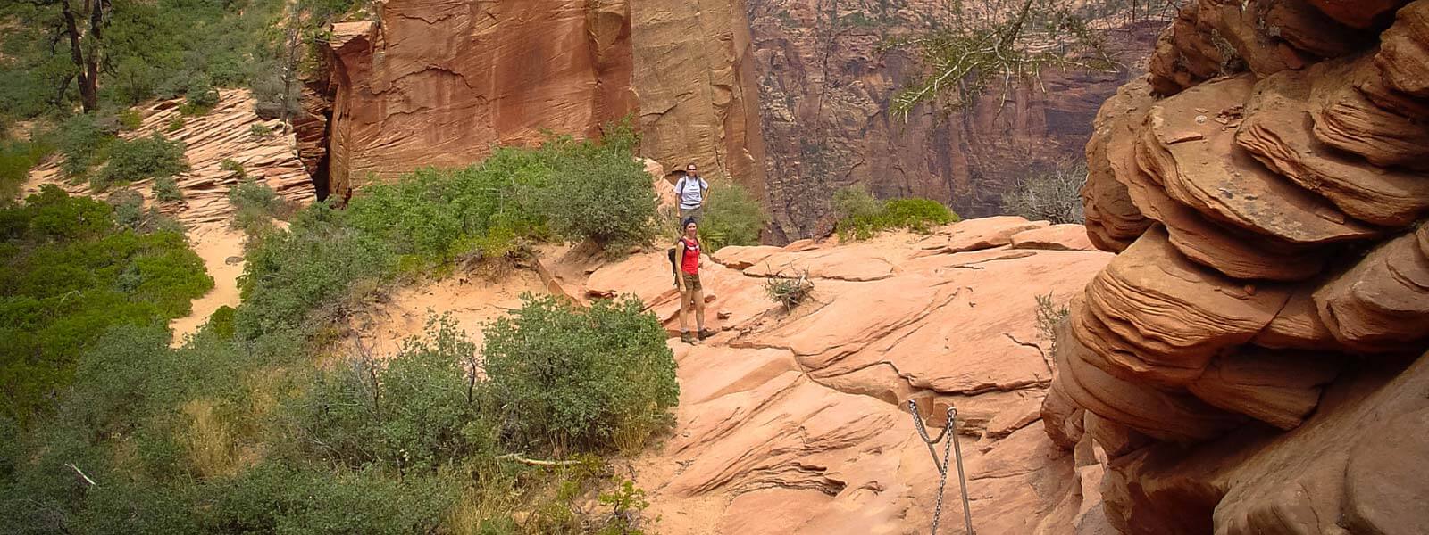
Did you notice the chains bolted into the rock in the image above? These come in extremely handy when you are on the final push and on some of the steeper parts of the trail. There are wider areas to walk on and explore. But when it does get narrow, the chains are there to help you out. We used the potholes in the sandstone rock as steps to aid us in ascending. Although the pictures make this hike look intimidating, it’s really not that bad. The elevation gain in this section is only about 500 feet.
The scenes of the Zion valley are breathtaking from this location. Take lots of pictures, but just don’t get too close to the edge. There have been several people who have fallen to their death over the years. The National Parks Service recommends hikers to use good judgement and avoid hiking this part of the trail if it rains, snows or if there are strong winds present.
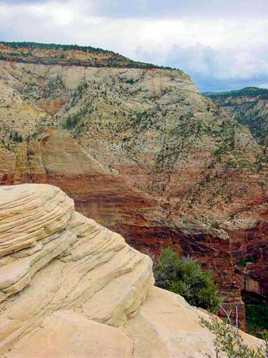
Once you make it to the top the views are magnificent and you will be thankful you completed the trail. At the summit, the sandstone is a bright yellow color and there are plenty of large flat areas to walk around to explore the breathtaking views on all sides. We were amazed at the heights and that we had made it safely to a peak elevation of 5,790 feet.
A couple of my friends couldn’t get over how steep the walls around us were as they peered over the side of the canyon. One even joked like he was falling. Not funny! You really don’t want to play around up here. Just eat your trail mix and enjoy the views safely.
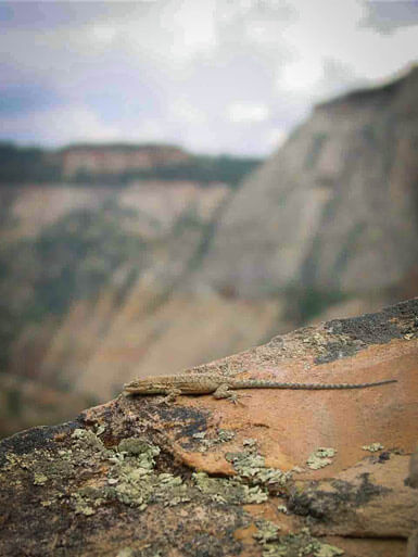
Fortunately for us there weren’t many people on the trail when we went. I can see how it could get pretty dicey if there were more people attempting to go up that last steep part. I was surprised to find this little lizard enjoying the views with us. Then again, sunning himself at the top of Angels Landing is probably part of his usual afternoon ritual. Lucky guy!
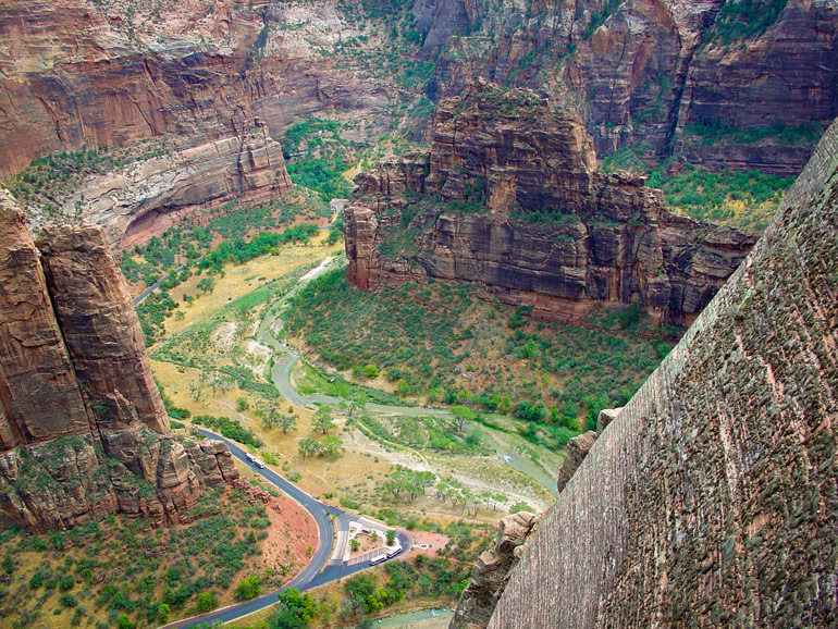
The views of Zion Canyon are gorgeous and so are the views on the opposite side that show the Virgin River wrapping around Big Bend. If you look closely you can see two tour buses on the dark black paved road all the way at the bottom of the canyon. I can’t stress enough what an adventurous hike this is. Sure it’s a little scary, but just be careful and you too can capture some images and memories that will certainly last you a lifetime.


